THE FOREST OF BOWLAND
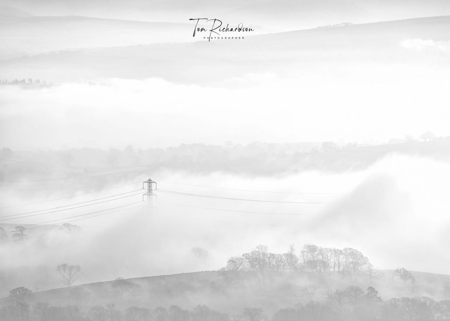
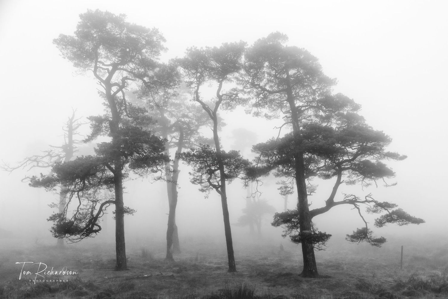
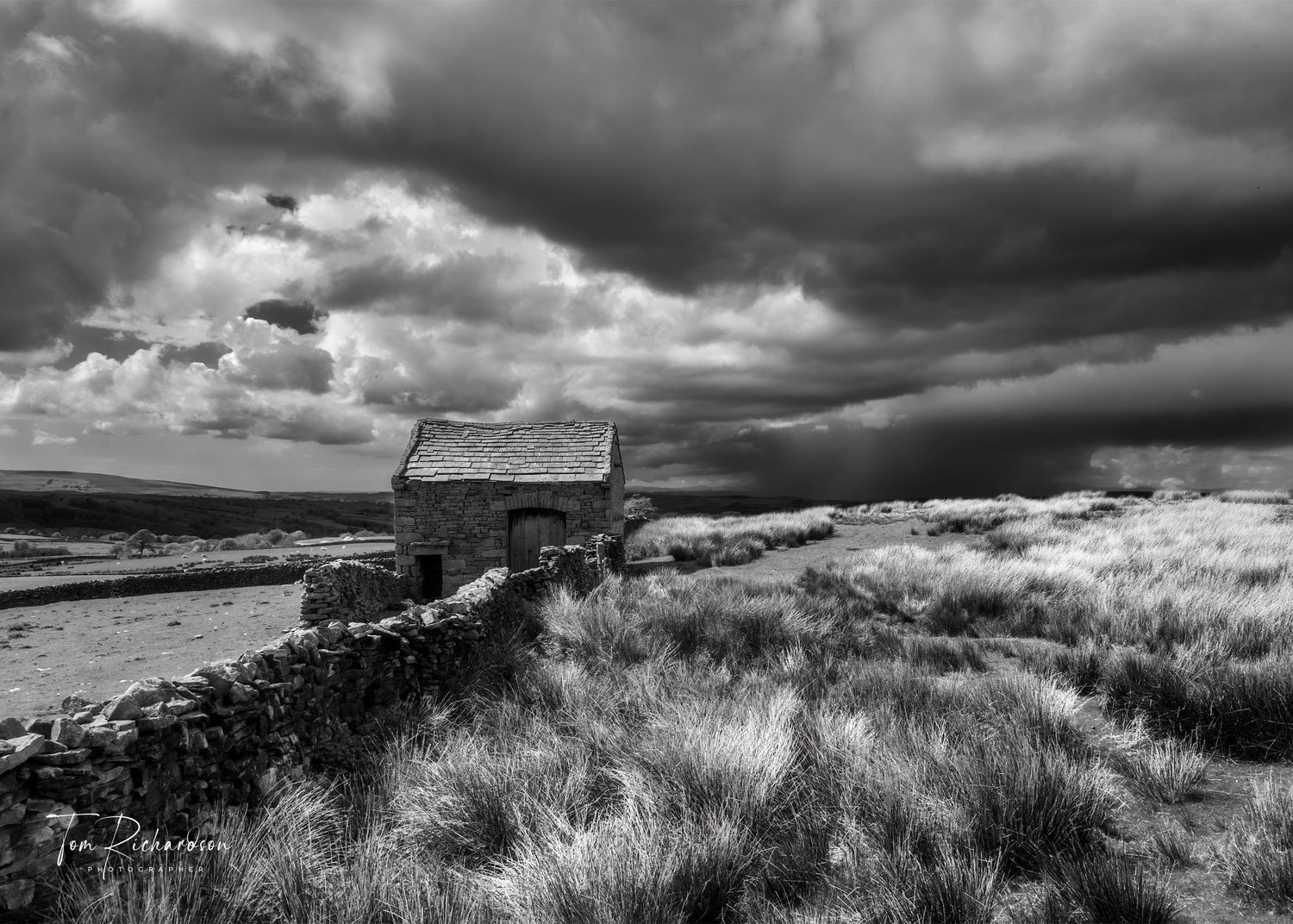
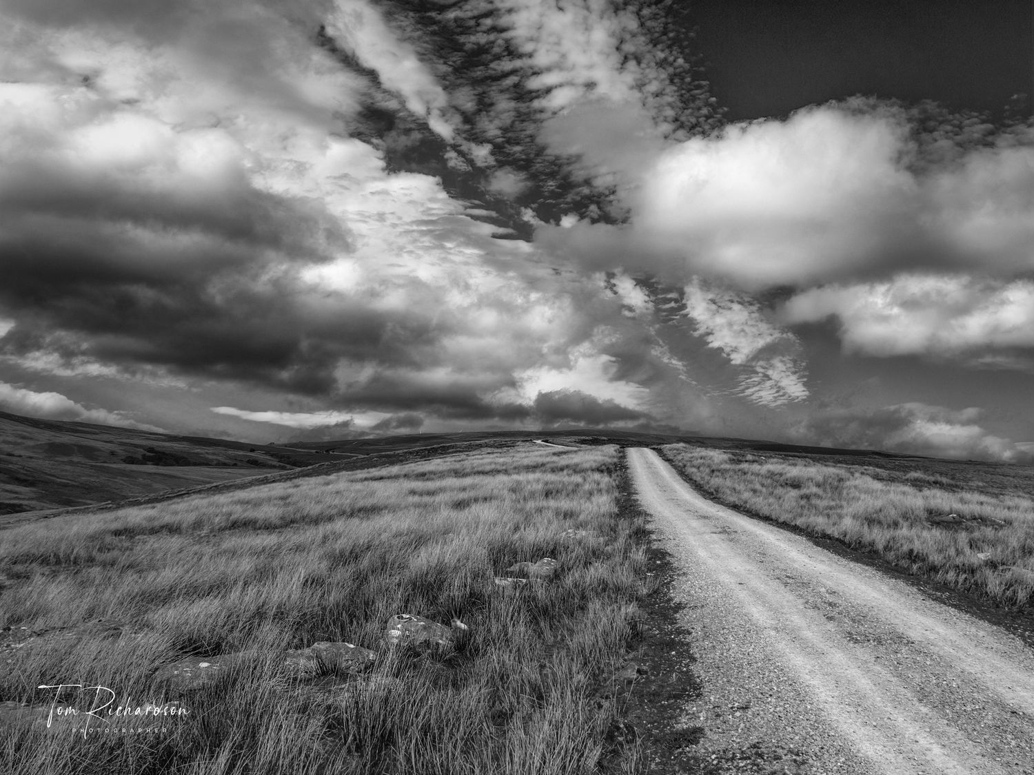
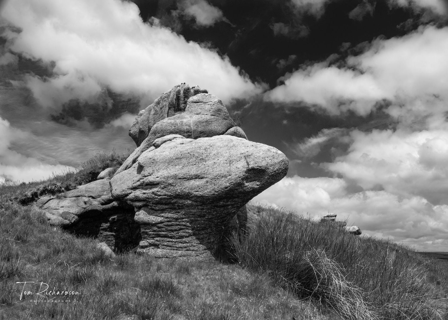
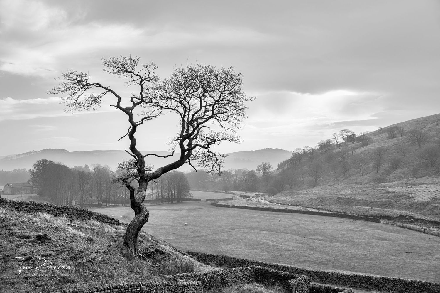
Lancashire's best kept secret is the Forest of Bowland AONB, a land of quaint historic stone built villages, wild moorland, gritstone outcrops and broad river valleys. Bowland covers an area of 312 square miles and is bounded by the River Lune to the north, The Ribble Valley to the south and east and the M6 motorway to the west.
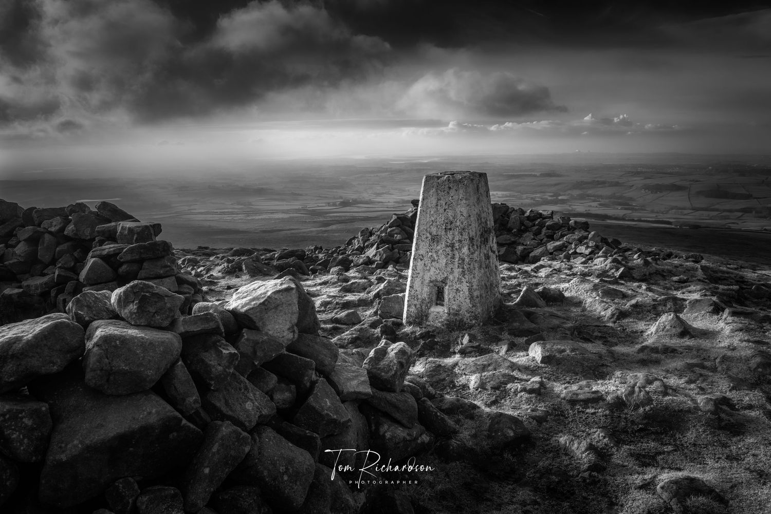
At 1,841 ft high remote Ward's Stone is its highest point and with over 170 named fell tops including 13 over 1,500 ft the area is fine walking country. The area is also rich in wildlife and historical interest.
![Looking to Bowland from Hutton Roof](http://images-pw.pixieset.com/elementfield/142256232/02_The_Pylon-f35f7063.jpg)
![Tracks in the snow near Brown Syke on Mallowdale Fell](http://images-pw.pixieset.com/elementfield/142256232/130122-39f91e45.jpg)
![Scots Pine in the mist near Trough Bridge, Marshaw](http://images-pw.pixieset.com/elementfield/142256232/140401-8954e137.jpg)
![Old Fence posts on Waddington Fell](http://images-pw.pixieset.com/elementfield/142256232/110815-cb4e9cb6.jpg)
![Barn at Lanshaw on The Slaidburn Road](http://images-pw.pixieset.com/elementfield/142256232/140513-0421a80e.jpg)
![Bowland Skies in Littledale](http://images-pw.pixieset.com/elementfield/142256232/Bowland_Skies121127-24a2b241.jpg)
![Crags at Cold Stone on Catlow Fell](http://images-pw.pixieset.com/elementfield/142256232/Coldstone_Crag_Catlow100826-b82eb2bb.jpg)
![Gritstone outcrops on Reeves Edge above Croasdale](http://images-pw.pixieset.com/elementfield/142256232/Evening_on_Reeves_Edge_White_Hill__Forest_of_Bowland101116-a31b2837.jpg)
![Brennand Tarn](http://images-pw.pixieset.com/elementfield/142256232/Brennand_tarn150310-3580bb30.jpg)
![](http://images-pw.pixieset.com/elementfield/142256232/Secret_Falls151014-b03117ee.jpg)
![Abandoned millstone at Rowantree Rocks above Marshaw](http://images-pw.pixieset.com/elementfield/142256232/Millstone_near_Rowantree_Rocks150310-f59b5419.jpg)
![Sighting Tower on White Hill](http://images-pw.pixieset.com/elementfield/142256232/Sighting_Tower_White_Hill101116-cb11ceb7.jpg)
![Trigpoint on Clough Fell](http://images-pw.pixieset.com/elementfield/142256232/Summit_of_Clougha_Pike160106-d0c817d8.jpg)
![Footpath to Nicky Nook at Slean End](http://images-pw.pixieset.com/elementfield/142256232/Woodland_Walk221221-2-31f75521.jpg)
![The Three Stone Men on Clougha Fell](http://images-pw.pixieset.com/elementfield/142256232/The_Three_Men_of_Clougha_2121213-479d06d3.jpg)
![The Salter Fell Road looking North](http://images-pw.pixieset.com/elementfield/142256232/110429-0e1615a1.jpg)
![Moorland Road above Roeburndale](http://images-pw.pixieset.com/elementfield/142256232/Cattlegrid_on_moorland_road_in_Roeburndale101107_copy-090c31c1.jpg)
![Knotteranum, Bowland Knotts](http://images-pw.pixieset.com/elementfield/142256232/Knotteranum_140513-b448df08.jpg)
![Whitendale Hanging Stones](http://images-pw.pixieset.com/elementfield/142256232/100615-b5761d8e.jpg)
![Gate on The Salter fell Road in Croasdale](http://images-pw.pixieset.com/elementfield/142256232/100624-0c294025.jpg)
![Cloud rolling in over Croasdale](http://images-pw.pixieset.com/elementfield/142256232/120914-52b6995e.jpg)
![The Langden Valley near Dunsop Bridge in The Forest of Bowland](http://images-pw.pixieset.com/elementfield/142256232/230214-ee818ecc.jpg)
![Tarnbrook](http://images-pw.pixieset.com/elementfield/142256232/The_route_of_the_Wyre_Way_as_it_passes_through_Tarnbrook_Village_in_The_Forest_of_Bowland230223-85dc0bd2.jpg)